|
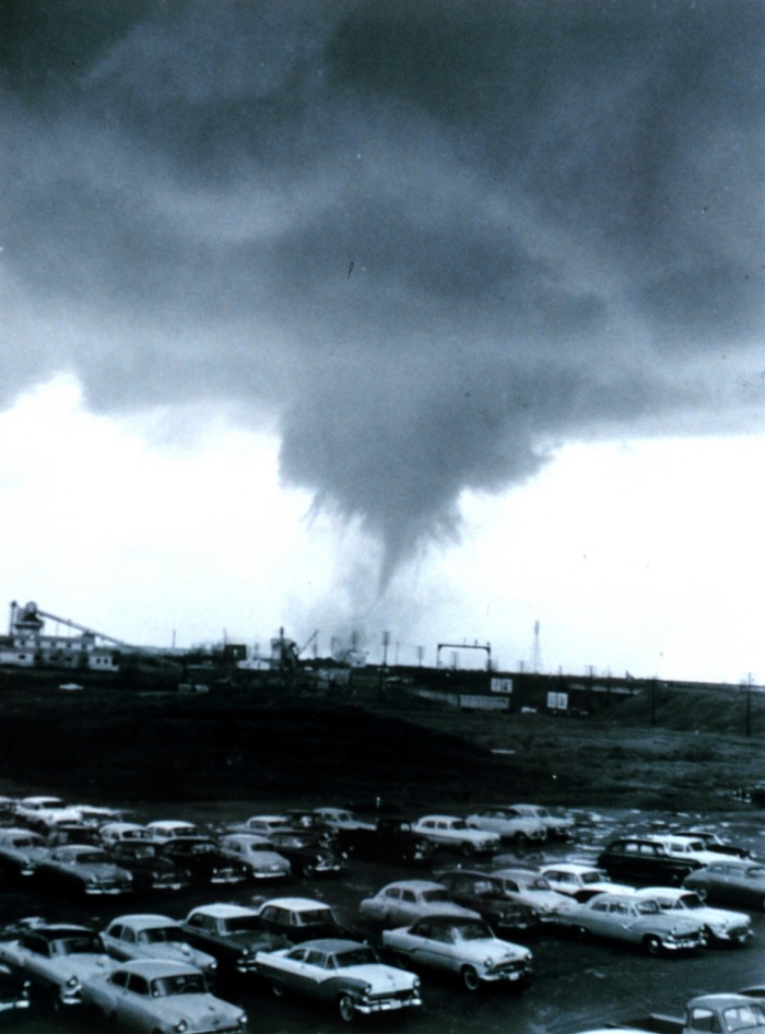
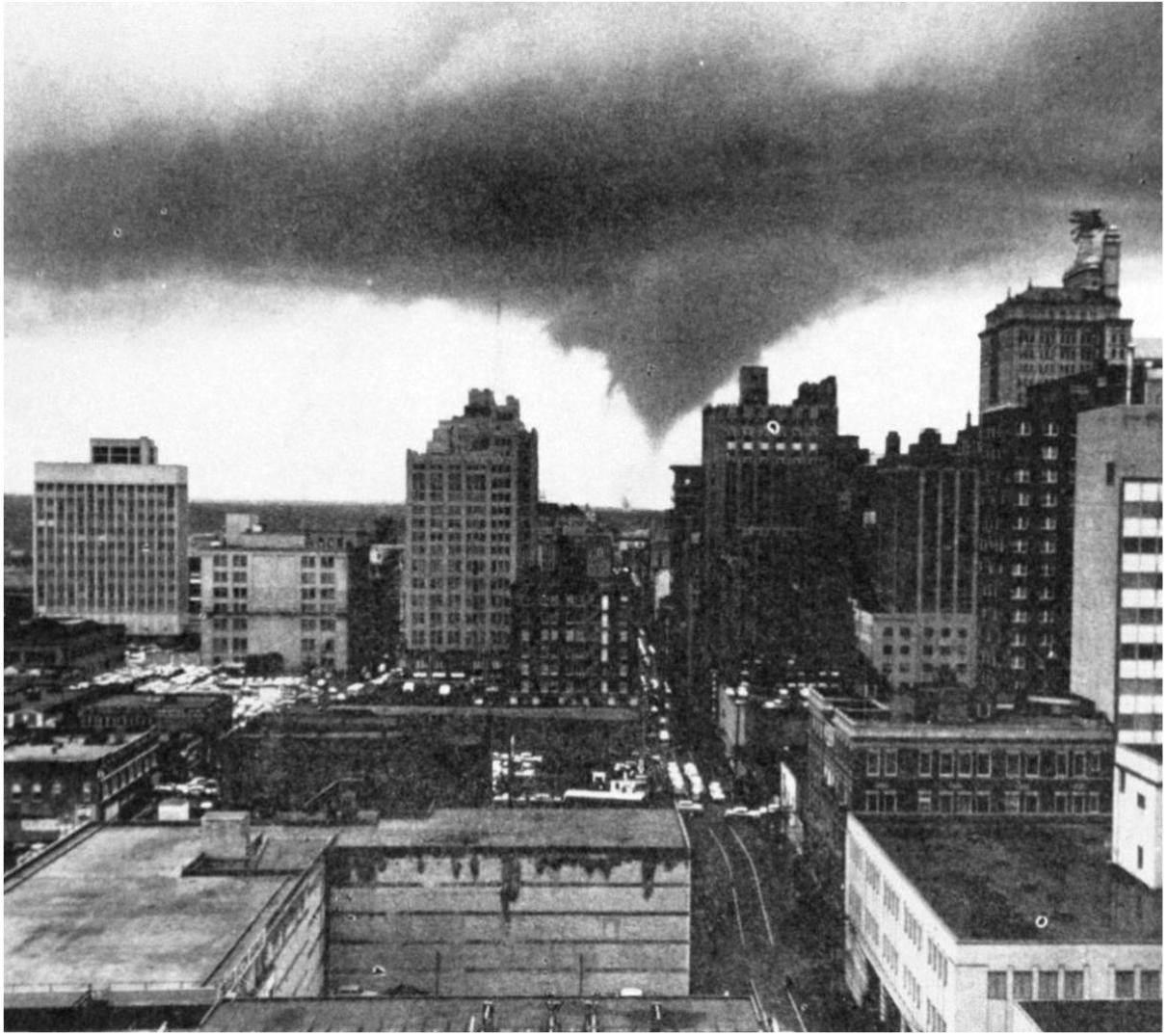
Dallas, April 2, 1957. Looking southwest down Jackson St. The city's landmark "flying red horse" atop the Magnolia Building can be seen at the upper right hand edge. The tornado is seen at about the time it crossed W. Commerce St. into West Dallas. Source: NOAA Photo Library. |
Photo
Sequence 1
Click
images for larger versions.
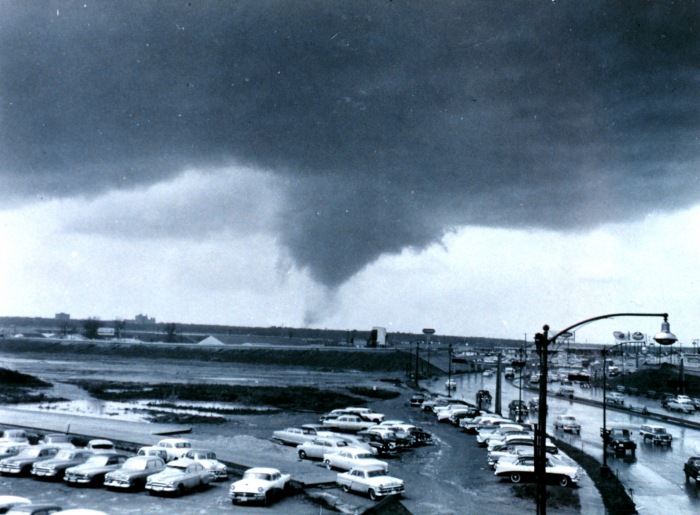
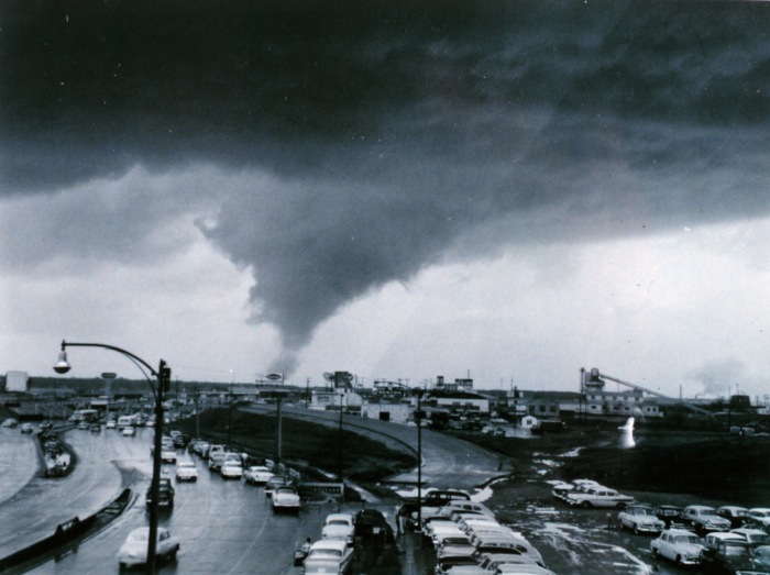
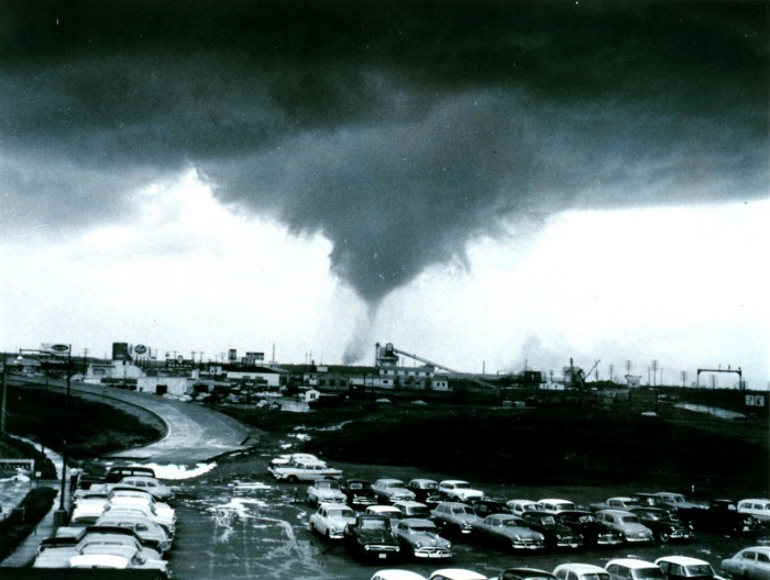
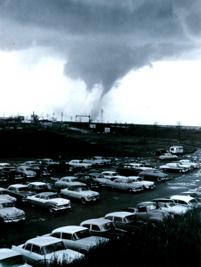
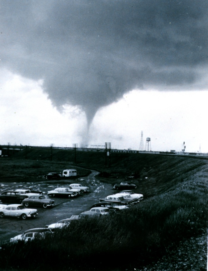
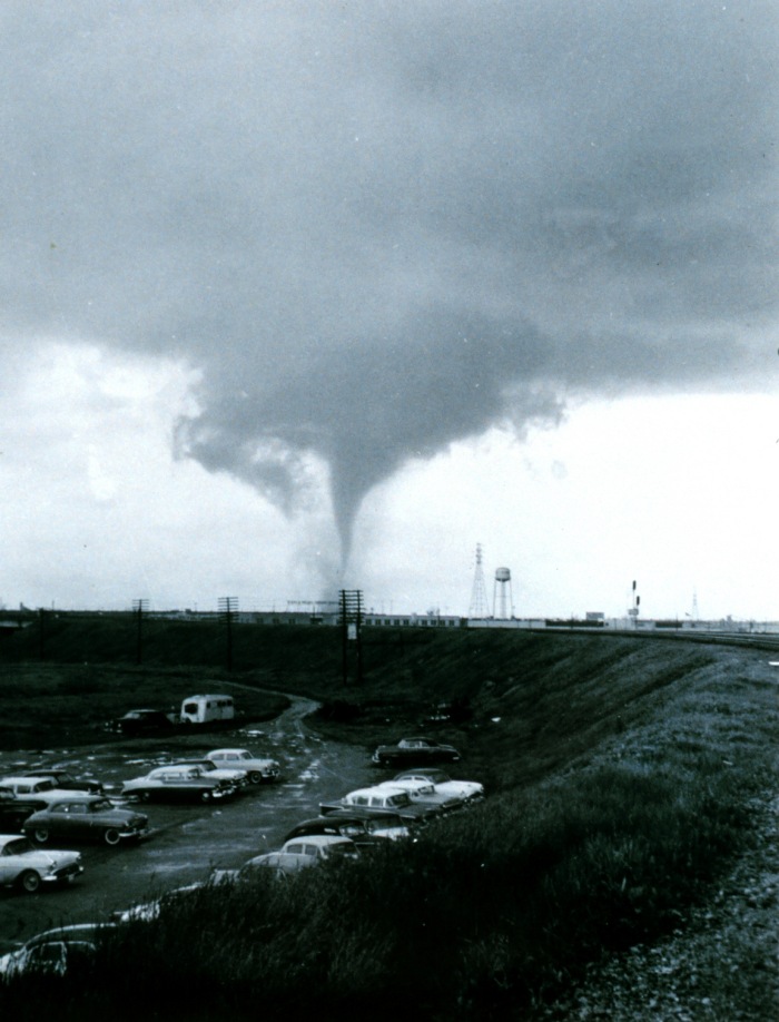
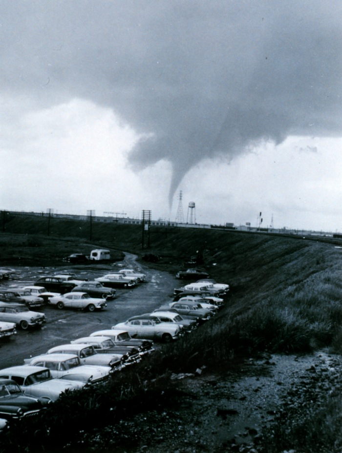
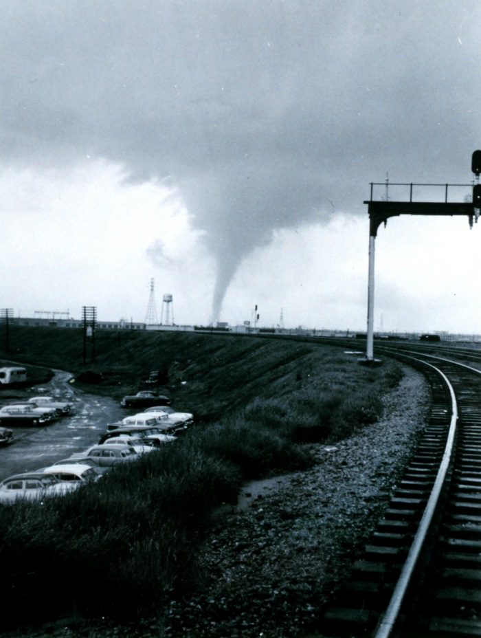
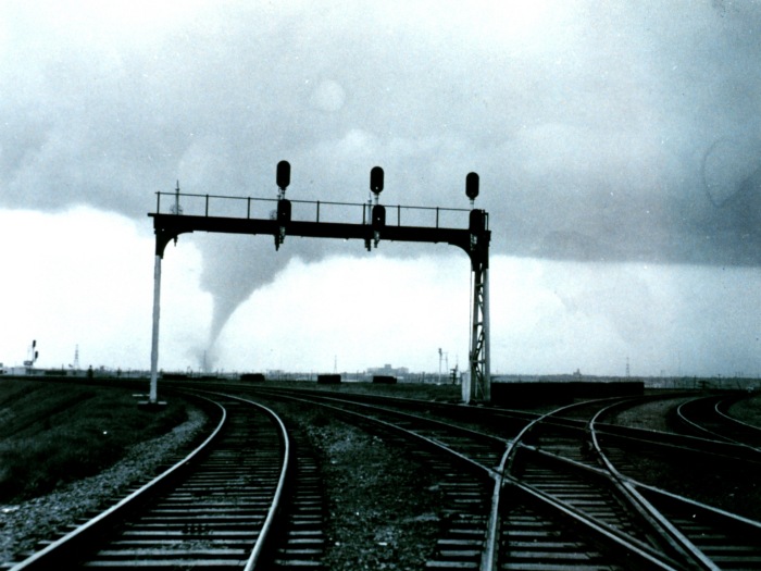
Dallas, April 2, 1957, looking southwest (1) to northwest (11) along Commerce St. and the MKT rail lines from over the triple underpass at the far southwest edge of downtown. The sequence runs from (1) the point where the tornado is in Kessler Park [M], follows it through West Dallas [N-O] and across the Trinity River [P] to (11) the point where it first enters Arlington Park. [Q] The left-hand building on the horizon in (1) is Methodist Hospital; the building on the horizon in (11) is Parkland Hospital. The earthen embankment running half way across the center of (1) is an early stage in the construction of the Dallas-Fort Worth Turnpike (now Interstate 30). This series illustrates quite well the remarkable viewing conditions existing at the time of the tornado. (Bracketed letters link to map with the corresponding locations marked. Many thanks to Trevor Henderson for identifying the photographer's location and several of the features.) Source: NOAA Photo Library.
|
|
|
|
|
|
|
|
|
|
|
|
|
|
|
|
Last updated 10 September, 2010